For localised crop loss and post-harvest loss under PMFBY (Pradhan Mantri Fasal Bima Yojana), the loss must be intimated within 72 hours of the event. The photos that help are clear, dated and located pictures of the damaged field, taken the same day. This post is for CSC operators, agriculture staff, insurer surveyors and farmers' helpers. It covers the rule, the photos to take, how a live-capture record can support your file, and what no photo can do.
PMFBY crop loss photos: what to know now (November 2026)
Rabi sowing is under way in many states, and unseasonal rain, hail or waterlogging can hit a field within hours. Four actions matter most.
- Count 72 hours from the event. For localised calamities and post-harvest loss, the clock starts when the damage happens.
- Intimate through an official channel first. The photos support the intimation. They do not replace it.
- Photograph the same day. Damage changes fast: water drains, crops are cleared, fields are tilled.
- Check your state's current notice. Cut-off dates, notified crops and insurers differ by state and season. Confirm on pmfby.gov.in or with the district agriculture office.
I could not read every clause of the guidelines PDFs in a browser, so confirm any detail you rely on against the official text before you advise a farmer.
What the rule is: the scheme and its crop insurance app
PMFBY is the central crop insurance scheme run by the Ministry of Agriculture and Farmers' Welfare. Its rules sit in the operational guidelines on pmfby.gov.in, dated 17 August 2020, with later amendments published on the same portal.
The guidelines treat two kinds of loss differently. Widespread calamities are assessed at the level of a notified area. Localised calamities and post-harvest losses are assessed on the individual insured field. Localised risks include hailstorm, landslide, inundation, cloud burst and natural fire from lightning. Some states add other risks, so check your notification.
The guidelines also say mobile apps may be used to report localised events with location and pictures. As reported by PIB, the government's press agency, farmers can report losses through the Crop Insurance App by uploading geo-tagged photographs. Verafii is not that app, and it does not file anything on a government portal.
The requirements, point by point
- 72-hour intimation: for localised calamity and post-harvest loss, the farmer or an agent reports the loss within 72 hours. The operational guidelines give this window, widened from 48 hours.
- An official channel: as reported on insurer and government pages, these include the Crop Insurance App, the 14447 helpline, the bank, a CSC or the agriculture office. Confirm the list for your state on pmfby.gov.in.
- Individual-field loss: the claim is on one insured field, so details must name that farmer, survey number and crop.
- Evidence of the loss: the guidelines expect pictures from a mobile application as evidence. Take more than the app asks for.
- Post-harvest loss: this applies to harvested crop left to dry in the field. The guidelines set a short period after harvest. Read the exact number of days in the current text.
Widespread loss is different. It follows the yield worked out from crop-cutting experiments, not from photos. A photo of a flooded field does not change that count.
What a good crop loss photo shows
The surveyor or loss assessor later sees only the picture. Frame so that someone who was never there can see the field, the crop and the damage.
- Field boundary: a wide shot from the bund or road, showing the whole plot and a fixed landmark.
- Crop stage and type: standing crop, grain stage or harvested bundles, so the crop is plain.
- Damage extent: walk the diagonal and photograph several spots, not one worst corner.
- Close-up of damage: hail-torn leaves, lodged stalks, cracked bolls, wet panicles.
- Cause: standing water, a landslide scar, burnt patch, hail on the ground.
- Undamaged part: if some of the field is fine, show it. It makes the rest more believable.
- Farmer and document: the farmer at the field, with the application or policy number written on paper in the frame.
- Short video: a slow pan across the field with the farmer's voice noting survey number and date.
Why an ordinary phone photo gets questioned
A reviewer cannot stand in your field. They can only ask whether the photo is of this field, on this date.
- The phone clock can be changed. A date on a photo means little if the clock is set by hand.
- Chat apps drop location. A photo sent over a messaging app usually loses its original location data.
- Gallery photos are old photos. Nothing shows when a picture from the gallery was actually taken.
- Typed stamps prove nothing. A watermark someone types can say anything.
- GPS drifts. Under tree cover, near buildings or in poor weather, a location can be off by tens of metres. A small gap is not fraud. Ask before you accuse.
The rule itself is not always clear on how much evidence each channel needs. Where it is unclear, ask the insurer's district office in writing and keep the reply.
How to do it with Verafii
Verafii is a live-capture camera and report app. It supports your evidence. It does not replace the Crop Insurance App, and the official intimation still goes through the official channels.
- Make the official intimation first, through the Crop Insurance App, the 14447 helpline, the bank, a CSC or the agriculture office. Note the time and any reference number.
- Open Verafii's own camera at the field. There is no gallery and no file picker, so every photo is taken live.
- Take the wide, mid and close-up shots from the list above. Each photo gets a GPS and time stamp burned in at the shutter.
- Record a short live video with audio, naming the farmer, survey number and crop.
- If there is no signal, carry on. Verafii captures offline and uploads when the phone is back online.
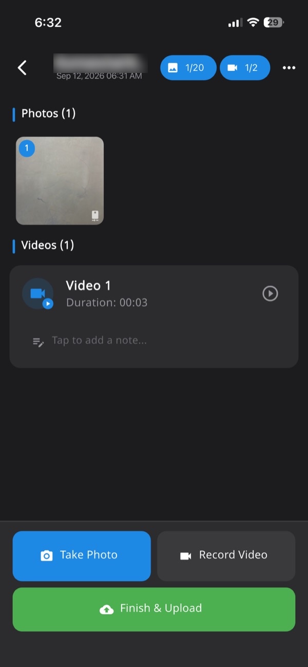
- Add notes to the job so every photo, video and note sits in one numbered record tied to the site.
- Generate the one-tap PDF report before leaving the field. It carries your logo, location, device, time and a QR code.
- If a fake location was used, the photo is flagged on the photo, report, verify page and dashboard.
Anyone can then check a Verafii report by scanning the QR, with no account or app. For general claim photo habits, see how to take photos for an insurance claim in India.

Keeping it organised across a survey team
A crop loss week means many farmers and many fields. Order matters more than volume.
- One job per farmer field. Name it with farmer, village, survey number and the date of the event.
- Same shot list for everyone. Share the list above so every surveyor captures the same set.
- Write the intimation reference in the job note. It ties your photos to the official record.
- Review on the dashboard. An admin can check each job and spot a missing close-up or a flagged location before the surveyor leaves the village.
- Be fair to your crew. Poor GPS under cloud and trees is common. Ask the surveyor first and retake the photo if needed.
The same discipline helps in other schemes. See stopping old photos being uploaded, and the wider GPS camera photo report page.
What this record can't do
- It does not file the claim. Intimation must go through the official channels within the time limit.
- It does not decide acceptance. The insurer, the department or a court decides what evidence they accept.
- It cannot prove the cause. A photo shows damage, not whether the cause is a notified risk.
- It cannot change widespread loss. Those follow crop-cutting results.
- It cannot prove the crop was insured or sown. Only the policy and the sowing record do that.
- It cannot promise approval or payment. No photo can.
- GPS can still be imprecise. A location may shift under heavy cloud or near structures.
What it does give is a located, timed set of live photos, a fingerprint of the report, and a public check.
A checklist before the deadline
- Note the date and hour of the event.
- Confirm the loss is localised or post-harvest, not widespread.
- Make the official intimation and keep the reference.
- Confirm the farmer's name, survey number and crop.
- Take wide, mid and close-up photos the same day.
- Photograph the cause and the undamaged part.
- Record a short video with audio.
- Generate the report before leaving the field.
- Share the report PDF and keep the QR link.
- Check pmfby.gov.in for notices that change the rules.
Frequently asked questions
What is the time limit to report crop loss under PMFBY?
For localised calamities and post-harvest loss, the scheme's operational guidelines give 72 hours from the event. Count from when the damage happened, not from when you noticed it. Check pmfby.gov.in for any amendment that applies to your state and season.
Does PMFBY need geo-tagged photos of crop loss?
As reported on the official PMFBY portal and in government releases, intimation through the Crop Insurance App carries photos of the damaged crop with location. Other channels may work differently. Ask the insurer or the agriculture office what evidence they want for your claim.
Can I use a Verafii photo for a PMFBY claim?
Verafii photos carry GPS, time and a QR report that anyone can check. Verafii does not file claims and does not replace the Crop Insurance App. Whether the insurer or the department accepts a photo is their decision, so use Verafii as your own supporting record.
Is widespread crop loss decided by photos?
No. Widespread calamity losses follow the yield estimated from crop-cutting experiments, as the operational guidelines set out. Photos of a whole district's damage do not change that process. Photos matter most for individual-farm, localised and post-harvest loss.
What if there is no mobile network in the field?
Verafii can capture with no signal and uploads when the phone is back online. The official intimation still needs a working channel, such as the Crop Insurance App, the 14447 helpline, a bank, a CSC or the agriculture office. Note the time you started trying, and try again from the nearest place with signal.
Will Verafii make sure my photos are accepted?
No. Acceptance is the insurer's and the department's decision. What Verafii gives you is a GPS and time stamp on each photo, a flag if a fake location was used, and a report with a QR that a reviewer can verify without an account.
Try it on your next crop loss survey
Start the 30-day free trial and test live capture and the one-tap report on a real field visit. Or ask for a quote: the price depends on your team, meaning field agents, admin users, how long evidence is kept, and photo and video quality. Verafii does not file claims. The official intimation goes through the official channels.
This article is general information, not legal advice.
